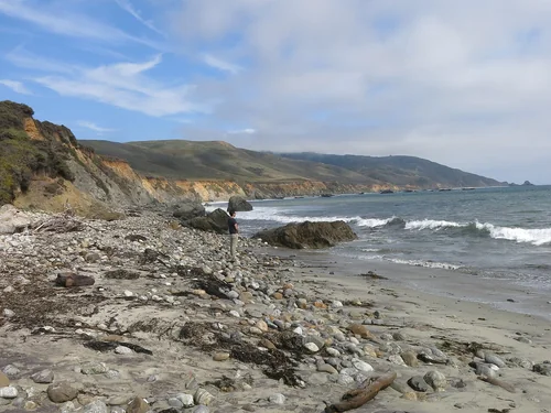
 State park
Andrew Molera State Park
19 miles south · straight-line distance
State park in California.
Confirm the visitor entrance, hours, reservations, access and seasonal conditions. Islands or water destinations may require different transport.
Get out of town
18 nearby parks, towns and places to explore, ordered by straight-line distance.
State park19 miles south · straight-line distance
State park in California.
Confirm the visitor entrance, hours, reservations, access and seasonal conditions. Islands or water destinations may require different transport.
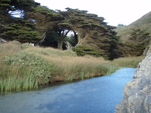 State park
23 miles south · straight-line distance
State park in Monterey County, California, United States.
Confirm the visitor entrance, hours, reservations, access and seasonal conditions. Islands or water destinations may require different transport.
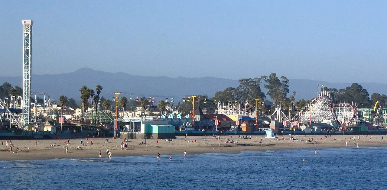
 Town
29 miles north · straight-line distanceAbout 50 min by car (47 road miles, typical traffic, checked October 2026)
City in and county seat of Santa Cruz County, California, United States.
Confirm the visitor entrance, hours, reservations, access and seasonal conditions. Islands or water destinations may require different transport.
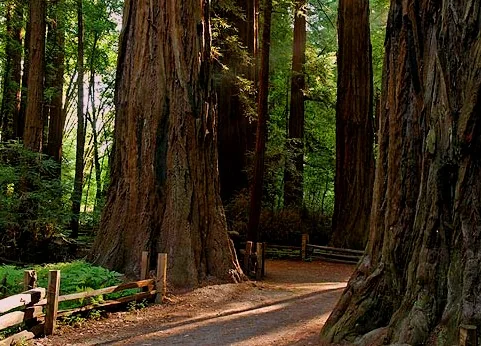 State park
33 miles north · straight-line distance
State park in Santa Cruz County, California, United States.
Confirm the visitor entrance, hours, reservations, access and seasonal conditions. Islands or water destinations may require different transport.
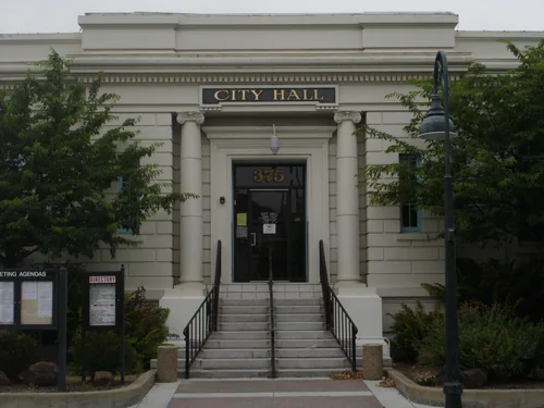 Town
35 miles northeast · straight-line distanceAbout 50 min by car (45 road miles, typical traffic, checked October 2026)
City in and county seat of San Benito County, California, United States.
Confirm the visitor entrance, hours, reservations, access and seasonal conditions. Islands or water destinations may require different transport.
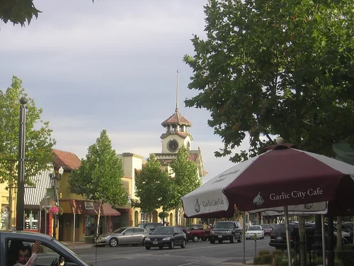 Town
37 miles northeast · straight-line distanceAbout 50 min by car (47 road miles, typical traffic, checked October 2026)
City in Santa Clara County, California, United States.
Confirm the visitor entrance, hours, reservations, access and seasonal conditions. Islands or water destinations may require different transport.
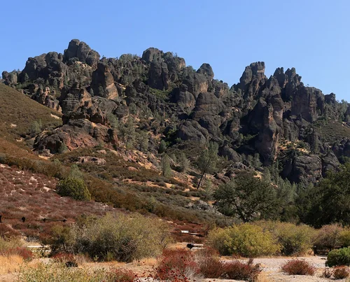 National park site
42 miles east · straight-line distance
National park in California, United States of America.
CampingClimbingHikingPicnickingWildlife viewingAgency site ↗
Confirm the visitor entrance, hours, reservations, access and seasonal conditions. Islands or water destinations may require different transport.
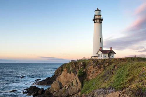 Outdoors
51 miles northwest · straight-line distanceAbout 1 hr 25 min by car (74 road miles, typical traffic, checked October 2026)
Lighthouse in California, United States.
Confirm the visitor entrance, hours, reservations, access and seasonal conditions. Islands or water destinations may require different transport.
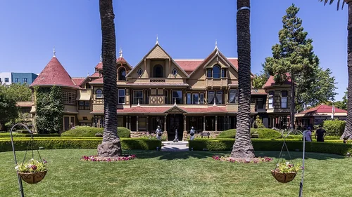 Things to do
53 miles north · straight-line distanceAbout 1 hr 20 min by car (73 road miles, typical traffic, checked October 2026)
Mansion in San Jose, California.
Official visitor information ↗Place source ↗Plan a route ↗
Confirm the visitor entrance, hours, reservations, access and seasonal conditions. Islands or water destinations may require different transport.
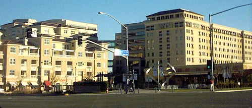 Town
53 miles north · straight-line distanceAbout 1 hr 20 min by car (75 road miles, typical traffic, checked October 2026)
City in Santa Clara County, California, United States.
Confirm the visitor entrance, hours, reservations, access and seasonal conditions. Islands or water destinations may require different transport.
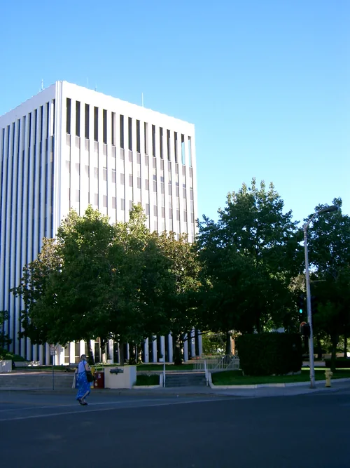 Town
63 miles north · straight-line distanceAbout 1 hr 35 min by car (94 road miles, typical traffic, checked October 2026)
City in Santa Clara County, California, United States.
LOCAL Palo Alto guide →Place source ↗Plan a route ↗
Confirm the visitor entrance, hours, reservations, access and seasonal conditions. Islands or water destinations may require different transport.
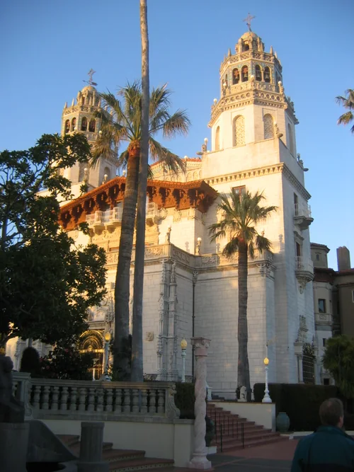 Things to do
73 miles southeast · straight-line distanceAbout 2 hr 10 min by car (96 road miles, typical traffic, checked October 2026)
National Historic Landmark and California Historical Landmark located on the Central Coast of California, United States.
Official visitor information ↗Place source ↗Plan a route ↗
Confirm the visitor entrance, hours, reservations, access and seasonal conditions. Islands or water destinations may require different transport.
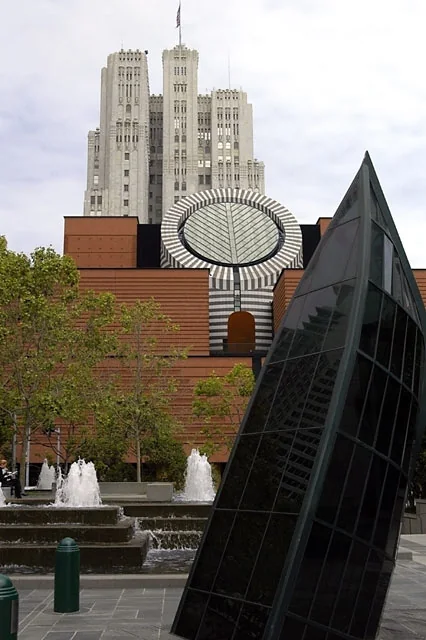 Things to do
89 miles north · straight-line distanceAbout 2 hr by car (123 road miles, typical traffic, checked October 2026)
Modern art museum in San Francisco, California, USA.
Official visitor information ↗Place source ↗Plan a route ↗
Confirm the visitor entrance, hours, reservations, access and seasonal conditions. Islands or water destinations may require different transport.
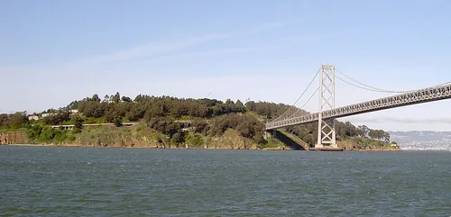 Outdoors
90 miles north · straight-line distance
Island in San Francisco, California, United States of America.
Confirm the visitor entrance, hours, reservations, access and seasonal conditions. Islands or water destinations may require different transport.
91 miles north · straight-line distance
United States national park in California.
Confirm the visitor entrance, hours, reservations, access and seasonal conditions. Islands or water destinations may require different transport.
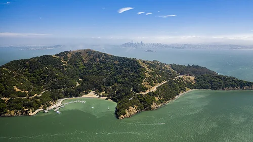 Outdoors
94 miles north · straight-line distance
Island in San Francisco Bay in California, United States of America.
Confirm the visitor entrance, hours, reservations, access and seasonal conditions. Islands or water destinations may require different transport.
99 miles north · straight-line distance
National Monument in the United States.
Confirm the visitor entrance, hours, reservations, access and seasonal conditions. Islands or water destinations may require different transport.
 National park site
117 miles northwest · straight-line distance
Protected national seashore in northern California, USA.
Confirm the visitor entrance, hours, reservations, access and seasonal conditions. Islands or water destinations may require different transport.
Driving times are typical estimates from the city center without live traffic, Powered by Geoapify · © OpenStreetMap contributors.
Distances are measured in a straight line from the city, not by road. Some older drive-time estimates have no reliable date and do not reflect current traffic; routes to large parks or waterfronts may vary. Check the destination entrance before leaving. Place descriptions come from Wikidata. Photo credits include capture dates when available; photos may not show current conditions.
40 recreation areas and campgrounds within 113 miles, from Recreation.gov. Filter by what you want to do.
4 miles northeast · straight-line distanceNational Oceanic and Atmospheric Administration
Monterey Bay National Marine Sanctuary is one of the most spectacular marine protected areas. This sanctuary also has one of the largest underwater canyons and closest-to-shore deep ocean environments.
BikingBoatingCampingDivingFishingHikingHorseback ridingPaddling
14 miles northeast · straight-line distanceFish and Wildlife Service
This 367-acre coastal National Wildlife Refuge is located where the Salinas River empties into Monterey Bay.
FishingHuntingWildlife viewing
21 miles northeast · straight-line distanceNational Oceanic and Atmospheric Administration
Elkhorn Slough is one of the relatively few undisturbed coastal wetlands remaining in California.
HikingPaddlingPhotographyRanger programsWildlife viewing
25 miles southeast · straight-line distanceAbout 1 hr 15 min by car (33 road miles, checked October 2026)USDA Forest Service
Amid a grove of towering trees, eight campsites create a loop within White Oaks Campground, just off Tassajara Road.
BikingCampingHikingWildlife viewing
27 miles southeast · straight-line distanceAbout 1 hr 25 min by car (35 road miles, checked October 2026)USDA Forest Service
Pleasantly nestled under a large canopy of pine trees, China Camp is a campground where peace and quiet is commonplace. The spacious campsites allow you to set up camp with more than enough space between you and your neighbors.
BikingCampingHikingWildlife viewing
32 miles southeast · straight-line distanceBureau of Land Management
The Ventana Wilderness now contains a total of 240,008 acres and is managed by the Bureau of Land Management and the Forest Service. All of the Wilderness is in the state of California.
Wilderness
33 miles southeast · straight-line distanceAbout 1 hr 20 min by car (47 road miles, checked October 2026)USDA Forest Service
Arroyo Seco Campground is a semi-rustic, but developed facility in California's westernmost national forest.
BikingCampingFishingHikingWildlife viewing
33 miles northeast · straight-line distanceBureau of Reclamation
San Justo Dam and Reservoir are features of the San Felipe Project. The reservoir is approximately 3 miles southwest of Hollister, California . Facilities open for use Wednesday through Sunday. Operation hours: sunrise to sunset.
BoatingFishingPicnickingRecreational Vehicles
37 miles southeast · straight-line distanceAbout 2 hr 45 min by car (100 road miles, checked October 2026)USDA Forest Service
Escondido Campground is one of the best kept secrets in the Santa Lucia Mountains. This family-friendly campground boasts scenic vistas that will take your breath away.
BikingCampingHiking
40 miles southeast · straight-line distanceAbout 2 hr 5 min by car (97 road miles, checked October 2026)USDA Forest Service
Escape the hustle and bustle of the city at Memorial Park -- a scenic and remote campground tucked away in the Santa Lucia Mountains.
BikingCampingHikingWildlife viewing
41 miles east · straight-line distanceNational Park Service
Around 23 million years ago, a series of volcanic eruptions shaped the landscape that is now Pinnacles National Park. The remnants of these ancient eruptions have formed a striking terrain of rocky spires and deep canyons.
CampingClimbingHikingPicnickingWildlife viewing
42 miles east · straight-line distanceNational Park Service
Pinnacles Campground is located in the unique Pinnacles National Park, 32 miles south of Hollister, California. The park encompasses 26,000 acres of spectacular rock formations and remnants of an extinct 23 million-year old volcano.
CampingClimbingHikingRanger programsWildlife viewing
46 miles southeast · straight-line distanceAbout 1 hr 10 min by car (56 road miles, checked October 2026)USDA Forest Service
Kirk Creek Campground is an oceanside paradise, with each site overlooking the Pacific Ocean. It offers a variety of opportunities for relaxation and recreation.
BikingBoatingCampingFishingHikingHuntingWater sportsWildlife viewing
49 miles southeast · straight-line distanceUSDA Forest Service
Ponderosa Campground offers visitors a beautiful location to relax and enjoy nature. It runs along the Nacimiento River, which provides a variety of recreational opportunities.
BikingCampingFishingHikingHistoryHuntingSwimmingWildlife viewing
51 miles southeast · straight-line distanceAbout 1 hr 15 min by car (61 road miles, checked October 2026)USDA Forest Service
Plaskett Creek Campground offers a beautiful location just minutes from Sand Dollar Beach, one of the largest and most popular beaches in central California.
BikingCampingFishingHikingHuntingWildlife viewing
53 miles northeast · straight-line distanceBureau of Reclamation
Recreation facilities at San Luis Lake were constructed under a cost-share agreement between the Bureau of Reclamation and the State of Colorado during the late 1980s and early 1990s.
BikingBoatingCampingFishingHikingHuntingPicnickingWater sports
58 miles northeast · straight-line distanceBureau of Reclamation
Recreation area lakes include O'Neill Forebay, San Luis Reservoir, and Los Banos Creek Reservoir.
BoatingFishingHorseback ridingHuntingRanger programsRecreational VehiclesWater sportsWinter sports
59 miles northeast · straight-line distanceBureau of Reclamation
O'Neill Dam and Forebay are joint Federal-State facilities located on San Luis Creek 2.5 miles downstream from San Luis Dam. O'Neill Forebay Dam is a feature of the Central Valley Project - San Joaquin Division - San Luis Unit .
BikingBoatingCampingFishingHikingHuntingPicnickingRecreational Vehicles
60 miles east · straight-line distanceBureau of Land Management
Within the steep and rugged Griswold Canyon, BLM land straddles both sides of the road.
BikingCampingHikingHorseback ridingHuntingPhotographyWildlife viewing
60 miles east · straight-line distanceBureau of Land Management
BikingCampingHikingHuntingPhotographyWildlife viewing
62 miles east · straight-line distanceBureau of Land Management
The Laguna Mountain Area consists of somewhat rugged terrain with rolling hills covered in dense brush. The area's vegetation is characterized by classic chapparal habitat, oak forests, and grassy meadows.
BikingCampingHikingHorseback ridingHuntingPhotographyWildlife viewing
62 miles northeast · straight-line distanceBureau of Reclamation
The Los Banos Dam and Reservoir are on Los Banos Creek above the San Luis Canal, near Los Banos, California. The dam and reservoir are features on the Central Valley Project - San Luis Unit .
BoatingCampingFishingHikingHistoryHorseback ridingHuntingPicnicking
64 miles east · straight-line distanceBureau of Reclamation
Little Panoche Dam is a feature of the Central Valley Project - San Luis Unit . The area is open 24 hours a day, 7 days a week. Access by foot only. Parking lot provided. Nearest main highway, I-5.
FishingHuntingPicnickingWildlife viewing
64 miles southeast · straight-line distanceBureau of Land Management
Located in southern Monterey County, and standing over 2,700 feet in elevation, Williams Hill offers great views of the surrounding Salinas Valley.
BikingCampingHikingHorseback ridingOff-highway vehiclesPhotographyWildlife viewing
68 miles north · straight-line distanceFish and Wildlife Service
Don Edwards San Francisco Bay National Wildlife Refuge is located in a vast cultural and natural landscape.
BikingBirdingBoatingFishingHuntingNature educationPhotographyRanger programs
71 miles east · straight-line distanceBureau of Land Management
Located on the outskirts of the Clear Creek Management Area (CCMA), Condon Peak offers rolling grass-covered slopes with a few tall pines and shrubs, as well as steep slopes and rocky outcrops covered with pine and brush.
BikingCampingHikingHorseback ridingPhotographyWildlife viewing
71 miles east · straight-line distanceBureau of Land Management
Look closely at the ground you will find evidence of the vast inland sea that once covered the Tumey Hills. The light porous rocks are composed of diatoms, the tiny, bleached, shell-like skeletons of sea algae.
BikingCampingHikingHorseback ridingPhotographyWildlife viewing
75 miles northeast · straight-line distanceFish and Wildlife Service
The San Luis National Wildlife Refuge encompasses over 26,800 acres of wetlands, riparian woodlands, native grasslands, and vernal pools. A thriving population of endemic tule elk is showcased on one of three auto tour routes.
BirdingFishingHikingHuntingPhotographyPicnickingWildlife viewing
81 miles east · straight-line distanceBureau of Land Management
The Coalinga Mineral Springs National Recreation Trail was designated under the National Recreation Trails System Act in 1981. The trail is located on the scenic southern tip of the Diablo Mountains.
BikingCampingHikingHorseback ridingHuntingPhotographyWildlife viewing
82 miles northeast · straight-line distanceFish and Wildlife Service
The San Joaquin River National Wildlife Refuge located in Stanislaus County encompasses more than 7,300 acres of riparian woodlands, wetlands, and grasslands that host a diversity of wildlife native to California’s Great Central Valley.
BirdingHikingPhotographyPicnickingWildlife viewing
84 miles northeast · straight-line distanceFish and Wildlife Service
The Merced National Wildlife Refuge encompasses 10,258 acres of wetlands, native grasslands, vernal pools, and riparian woodlands.
BirdingHikingHuntingNature educationPhotographyPicnickingWildlife viewing
84 miles southeast · straight-line distanceBureau of Land Management
Private property surrounds Stockdale Mountain. Do not enter through private gates or fences.
BikingCampingHikingHorseback ridingHuntingPhotographyWildlife viewing
88 miles north · straight-line distanceNational Park Service
America's only Nobel Prize-winning playwright, Eugene O'Neill, chose Northern California as his sanctuary at the pinnacle of his writing career.
History
91 miles north · straight-line distanceAbout 2 hr 5 min by car (125 road miles, checked October 2026)National Park Service
Aquatic Park Cove is a vibrantly urban harbor that mimics a natural anchorage and is located on the Pacific shores of one of America's great West Coast cities.
BikingBoatingCampingClimbingFishingHikingHistoryHorseback riding
91 miles north · straight-line distanceAbout 2 hr 10 min by car (120 road miles, checked October 2026)Presidio Trust
As San Francisco's only group campground, Rob Hill offers a national park camping experience just minutes from the city.
BikingBirdingCampingHikingHistory
94 miles north · straight-line distanceAbout 2 hr 20 min by car (125 road miles, checked October 2026)National Park Service
Bicentennial Campground is in an ideal location in the Marin Headlands surrounded by a grove of cypress trees. The campground is a great location for those wanting to camp near the city.
BikingCampingHistoryMountain Biking
94 miles north · straight-line distanceAbout 2 hr 15 min by car (123 road miles, checked October 2026)National Park Service
Kirby Cove is located just north of the Golden Gate Bridge at historic Battery Kirby. Visitors are awarded breathtaking views of San Francisco, its famous Golden Gate Bridge, and the rugged Pacific Coast of northern California.
BirdingCampingFishingHikingHistoryMountain BikingPicnickingWater Access
96 miles north · straight-line distanceNational Park Service
Haypress Campground is nestled within the coastal scrub of Tennessee Valley, near Mill Valley. The hike to this campground is 1 mile from the Tennessee Valley Trail head parking lot, which means car or RV camping is not allowed.
BikingBirdingCampingHikingWildlife viewing
102 miles southeast · straight-line distanceAbout 2 hr 20 min by car (138 road miles, checked October 2026)USDA Forest Service
Cerro Alto Campground is a well-known hiking and mountain biking paradise. It is located a short distance from the sandy beaches of Morro Bay, where visitors enjoy surfing, fishing, kayaking, sailing, scuba diving and more.
BikingBoatingCampingFishingHikingHuntingSwimmingWater sports
113 miles northwest · straight-line distanceAbout 2 hr 55 min by car (153 road miles, checked October 2026)National Park Service
Point Reyes National Seashore offers four backcountry hike in campgrounds and thirteen boat in campsites along Tomales Bay. Note: For reservation purposes, our campgrounds are organized under the "loop" column of the reservation grid.
BackpackingBikingBirdingBoatingCampingHikingHistoryHorse Camping
From the National Park Service; closures, dangers and cautions only. Check the park's page before you go.
Recreation areas and campgrounds from Recreation.gov's directory, checked October 9, 2026. Listings are not live availability: check Recreation.gov or the managing agency for open dates, fees, reservations and conditions. Directions go to the listed coordinates, which may not be the entrance. Campground driving times: Powered by Geoapify · © OpenStreetMap contributors.
This guide includes Andrew Molera State Park, Pfeiffer Big Sur State Park, Santa Cruz, Henry Cowell Redwoods State Park, Hollister. Places are ordered by straight-line distance. Confirm visitor access, opening hours and current travel conditions before choosing a trip.
Approximately 19 miles south in a straight line. This is not current traffic or a route to a confirmed visitor entrance. Check your route before leaving.
Approximately 23 miles south in a straight line. This is not current traffic or a route to a confirmed visitor entrance. Check your route before leaving.
Approximately 29 miles north in a straight line; driving takes about 50 min over 47 road miles in typical traffic (Geoapify, checked October 2026). This is not current traffic or a route to a confirmed visitor entrance. Check your route before leaving.
Recreation.gov lists 16 campgrounds within 113 miles, including White Oaks Campground (25 miles southeast), China Camp Campground (27 miles southeast), Arroyo Seco (33 miles southeast). Check Recreation.gov for current availability, seasons and reservations.